Welcome to DU!
The truly grassroots left-of-center political community where regular people, not algorithms, drive the discussions and set the standards.
Join the community:
Create a free account
Support DU (and get rid of ads!):
Become a Star Member
Latest Breaking News
General Discussion
The DU Lounge
All Forums
Issue Forums
Culture Forums
Alliance Forums
Region Forums
Support Forums
Help & Search
General Discussion
Related: Editorials & Other Articles, Issue Forums, Alliance Forums, Region Forums
InfoView thread info, including edit history
TrashPut this thread in your Trash Can (My DU » Trash Can)
BookmarkAdd this thread to your Bookmarks (My DU » Bookmarks)
9 replies, 4043 views
ShareGet links to this post and/or share on social media
AlertAlert this post for a rule violation
PowersThere are no powers you can use on this post
EditCannot edit other people's posts
ReplyReply to this post
EditCannot edit other people's posts
Rec (45)
ReplyReply to this post
9 replies
 = new reply since forum marked as read
Highlight:
NoneDon't highlight anything
5 newestHighlight 5 most recent replies
= new reply since forum marked as read
Highlight:
NoneDon't highlight anything
5 newestHighlight 5 most recent replies
= new reply since forum marked as read
Highlight:
NoneDon't highlight anything
5 newestHighlight 5 most recent replies
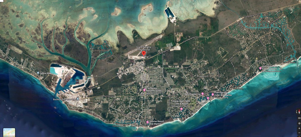
Graphic satellite image showing how flooded Grand Bahama Island is. :-O (Original Post)
Roland99
Sep 2019
OP
Saw a video clip of a woman in a one-story house on the outer edge of the island.
Coventina
Sep 2019
#1
I've been watching a lot of clips, I'm surprised that the death toll is only 5. I think it will...
Shell_Seas
Sep 2019
#2
Even though the center of Dorian has moved north they're still getting pounded
groundloop
Sep 2019
#8

Coventina
(27,106 posts)1. Saw a video clip of a woman in a one-story house on the outer edge of the island.
She was refusing to evacuate.
She's probably dead now.

Shell_Seas
(3,332 posts)2. I've been watching a lot of clips, I'm surprised that the death toll is only 5. I think it will...
go up drastically after the dust settles. 
Coventina
(27,106 posts)3. Agreed. And, probably some will never be found.


PunkinPi
(4,875 posts)4. Here's a side by side (before and after)...

FakeNoose
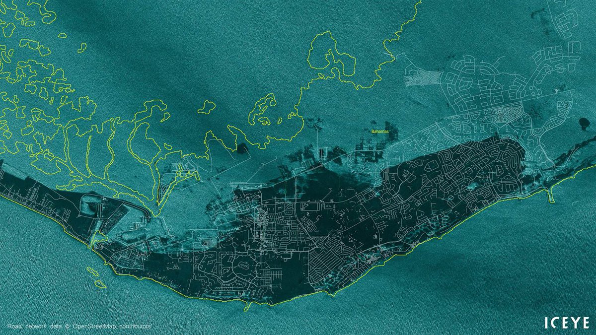
(32,634 posts)5. Topographic map shows elevation of Grand Bahama Island
Link to tweet
text:
Robert Rohde @RARohde
This is a topographic map of Grand Bahama island.
Green: 0-15 ft
Yellow: 15-30 ft
Red: 30+ ft
Dorian's storm surge is estimated at 18-23 ft, which would submerge everything in green and significant parts of the yellow. Hopefully most people managed to move to safe locations.

mnhtnbb
(31,384 posts)6. It was reported yesterday that the airport was 5-6 feet under water.

George II
(67,782 posts)7. Frightening.

groundloop
(11,518 posts)8. Even though the center of Dorian has moved north they're still getting pounded

malaise
(268,952 posts)9. the good news
Dorian is finally moving - PHEW!
Watch the death toll rise