Welcome to DU!
The truly grassroots left-of-center political community where regular people, not algorithms, drive the discussions and set the standards.
Join the community:
Create a free account
Support DU (and get rid of ads!):
Become a Star Member
Latest Breaking News
General Discussion
The DU Lounge
All Forums
Issue Forums
Culture Forums
Alliance Forums
Region Forums
Support Forums
Help & Search
Environment & Energy
Related: About this forumFirst Downburst On Record For NWT Flattened 200 Square Miles Of Forest - Equal To F2 Tornado
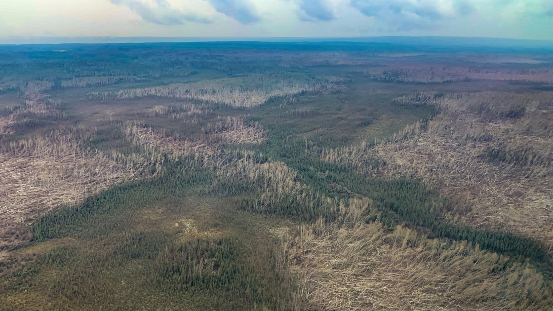
A downburst, one of the first ever recorded in the Northwest Territories, ripped through a patch of trees some 60 kilometres long and nine kilometres wide when it struck east of Fort Liard on June 29. Photographed from the air, the devastation made entire sections of forest look more like dried grass. Details of the event were reported this week for the first time by the Northern Tornadoes Project.
A downburst is not a tornado, but its aftermath can look a lot like a tornado passed through. Downbursts are powerful and fast storms with strong winds accompanied by rain, thunder, lightning, and occasionally hail. Air rushing down from the storm spreads out in unusually destructive fashion, causing the damage to trees seen on June 29.
Wind speeds during the Dehcho storm reached up to 190 km/h, researchers believe. The downburst registered as the equivalent of an EF-2 tornado on the Enhanced Fujita scale, a measurement of wind damage intensity where the lightest is EF-0 and the most severe is EF-5. “To have an event of this magnitude up there? I think it may be the first of its kind,” said Dr David Sills at Western University, executive director of the Northern Tornadoes Project.
EDIT
Link to tweet
While only one downburst event will enter the record for the NWT on June 29, Sills says aerial images suggest a cluster of individual wind bursts were responsible for the damage. “You see a series of these fan-shaped patterns in the trees. Each of them is that wind from the thunderstorm, air from the thunderstorm, descending and spreading out,” he said. “It’s all connected. They’re just single spots but they’re part of a large area of damage. We’ve drawn a line around all of these, where all the damage occurred, and said this was one downburst.”
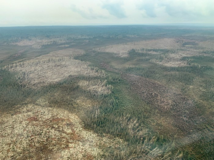
Downed trees are seen in an aerial image taken after a downburst east of Fort Liard in 2021. ENR/GNWT
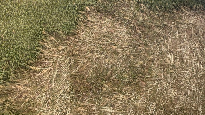
A closer image of downed trees from a downburst in the Dehcho region. ENR/GNWT
EDIT
https://cabinradio.ca/84015/news/environment/what-obliterated-these-dehcho-trees-a-downburst/
InfoView thread info, including edit history
TrashPut this thread in your Trash Can (My DU » Trash Can)
BookmarkAdd this thread to your Bookmarks (My DU » Bookmarks)
3 replies, 915 views
ShareGet links to this post and/or share on social media
AlertAlert this post for a rule violation
PowersThere are no powers you can use on this post
EditCannot edit other people's posts
ReplyReply to this post
EditCannot edit other people's posts
Rec (15)
ReplyReply to this post
3 replies
 = new reply since forum marked as read
Highlight:
NoneDon't highlight anything
5 newestHighlight 5 most recent replies
= new reply since forum marked as read
Highlight:
NoneDon't highlight anything
5 newestHighlight 5 most recent replies
= new reply since forum marked as read
Highlight:
NoneDon't highlight anything
5 newestHighlight 5 most recent replies
First Downburst On Record For NWT Flattened 200 Square Miles Of Forest - Equal To F2 Tornado (Original Post)
hatrack
Jan 2022
OP

wendyb-NC
(3,328 posts)1. That's astounding
The implications are mind blowing.
hatrack
(59,587 posts)2. Yes, a whole lot of interesting things are happening in the north . .. .
Melting permafrost, beavers moving north, methane releases, vast forest fires, disappearing multi-year sea ice, collapsing salmon runs, disintegrating roads and infrastructure . . . .
mitch96
(13,912 posts)3. Bullschizer I say... it's obvious that this a HUGE crop circle caused by aliens. ALIENS I SAY!

doing the pivot b/4 the tin hat crowd does...
m