Welcome to DU! The truly grassroots left-of-center political community where regular people, not algorithms, drive the discussions and set the standards. Join the community: Create a free account Support DU (and get rid of ads!): Become a Star Member Latest Breaking News General Discussion The DU Lounge All Forums Issue Forums Culture Forums Alliance Forums Region Forums Support Forums Help & Search
phantom power

(25,966 posts)
Mon Nov 12, 2012, 11:03 AM Nov 2012

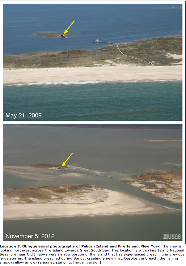
Before and After Superstorm Sandy- USGS Releases Amazing pics.

More photos thru the link

Barrier Islands are nature’s buffer from storms. New inlets are a natural occurrence during storms and the sands are constantly shifting. Building on them is fraught with risk, but taxpayers all pay for the federal flood insurance that protects property owners there. After Sandy, I suspect there will be a much greater discussion about whether this is a good idea. Without flood insurance far fewer people will take the risk, but this has economic considerations as well.

Betting against the water rising on a barrier island is ALWAYS a bad bet. Add in climate change and it becomes a foolish one as well.

http://blogs.agu.org/wildwildscience/2012/11/10/before-and-after-superstorm-sandy-usgs-releases-amazing-pics/


1 replies = new reply since forum marked as read
Highlight: NoneDon't highlight anything 5 newestHighlight 5 most recent replies
Before and After Superstorm Sandy- USGS Releases Amazing pics. (Original Post) phantom power Nov 2012 OP
wow tama Nov 2012 #1
Latest Discussions»Issue Forums»Environment & Energy»Before and After Supersto...