Satellite View of Guatemalan Volcano Erupting
by NANCY ATKINSON on SEPTEMBER 14, 2012
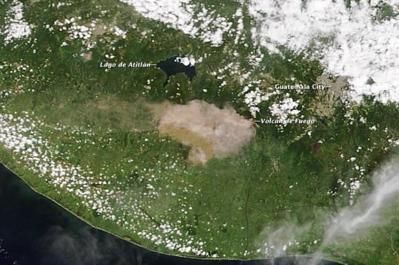
A natural-color image captured the eruption of Volcan de Fuego as it occurred. Credit: NASA/Moderate Resolution Imaging Spectroradiometer (MODIS) aboard the Terra satellite.
One of Central American’s most active volcanos erupted on September 13th, 2012 prompting officials to evacuate 35,000 residents in Guatemala. The Volcan de Fuego, or Fire Volcano, began belching out ash at 10 a.m. local time with ash now falling up to 40 kilometers (25 miles) from the volcano. Residents within 20 kilometers (12 miles) of the volcano were being removed from the area in buses and cars.
According to the Coordinadora Nacional para la Reducción de Desastres (CONRED), the eruption included ash emissions to the west and a 500-meter (2,000-foot) long lava flow. CONRED also warned of pyroclastic flows that could descend the mountain in any direction.
Read more: http://www.universetoday.com/97380/satellite-view-of-guatemalan-volcano-erupting/