General Discussion
In reply to the discussion: In deadly Texas floods, one town had what some didn't: A wailing warning siren [View all]
LeftInTX
(33,032 posts)That's because wildfires controlled vegetation before it was settled.
There is no industry in the area. The soil is so rocky that crops can't be grown. Angora goats are the most common livestock.
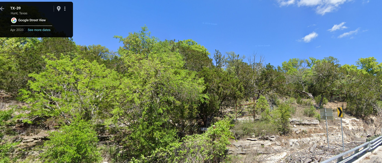
Here is natural vegetation at the headwaters of the Guadalupe River. Notice that trees literally grow out of rocks. Notice there is no soil. Seeds drop in cracks and and sometimes it takes years for plants to germinate. It doesn't rain very much over here! It's semi-arid.
Below these rocks are caves with water.
The junipers slow water runoff.
Here is vegetation on the Guadalupe River at the city park in downtown Kerrville
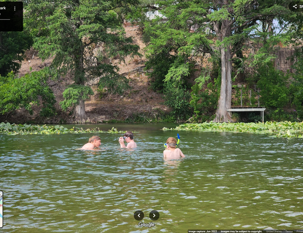
Notice the beautiful bald cypress. The cypress trees do moderate the flows. Cypress only grow in the water.
Our rivers and water are sacred! These towns basically exist as resorts.
There are beavers in the area, but their populations are low. They have never been hunted for fur in this part of Texas.
East Texas, is an entirely different ecosystem. If you look at maps of East Texas, you will see lush vegetation. Yet that is a timber producing area and it gets about 60 inches of rain per year. There is lot of industry in East Texas too. It all has to do with the amount of rain. So, lush doesn't tell the whole story!
I agree that Camp Mystic is in a terrible place with regards to flooding. It's between a creek and the river and it appears much of it literally in an old river bank. (Maybe built on a gravel bar). It also appears to have a dry creek coming from the top of the hill. (arroyo) If you built prior to flood zoning, your structures can stay. Camp Mystic has been around since 1926. Also, FEMA allows "cabins", "temporary structures" in flood plains.
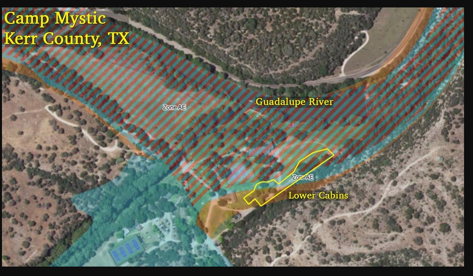
Map Shows Texas Girls’ Camp Where Dozens Drowned Was Located in High-Risk Flood Zone (Caveat: Many campgrounds in parks, state and national are in food zones!. Plop your tent next to a lake. You are taking a risk. You are generally responsible for monitoring the weather)
https://www.realtor.com/news/real-estate-news/map-texas-girls-camp-mystic-flood-zone/
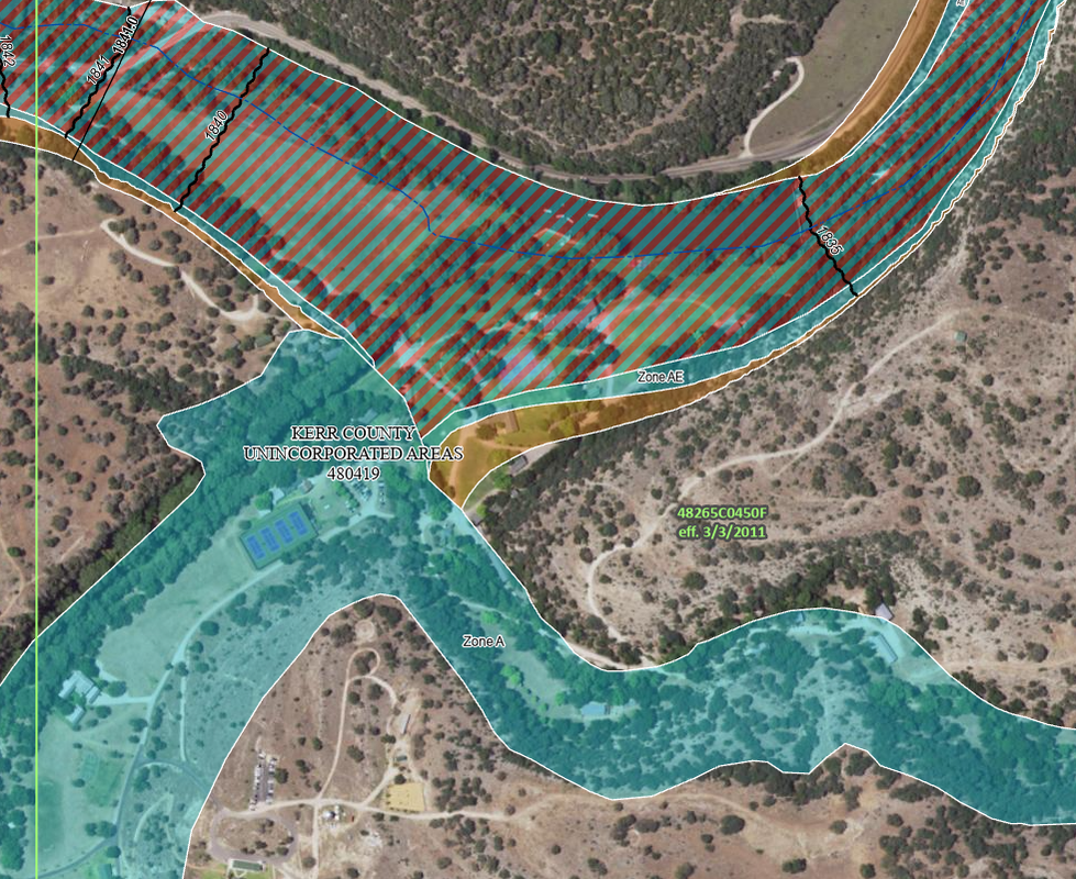
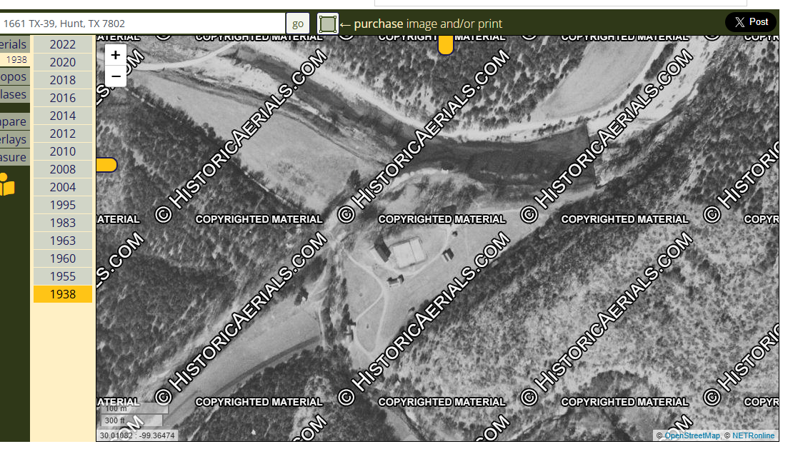
Here is the oldest aerial of Camp Mystic that I can find. It's from 1938. There also seems to be a drainage channel from the top of the hill. It may look benign when dry, but those areas can turn into torrents.
Edit history
Recommendations
1 members have recommended this reply (displayed in chronological order): = new reply since forum marked as read
Highlight:
NoneDon't highlight anything
5 newestHighlight 5 most recent replies
RecommendedHighlight replies with 5 or more recommendations
= new reply since forum marked as read
Highlight:
NoneDon't highlight anything
5 newestHighlight 5 most recent replies
RecommendedHighlight replies with 5 or more recommendations