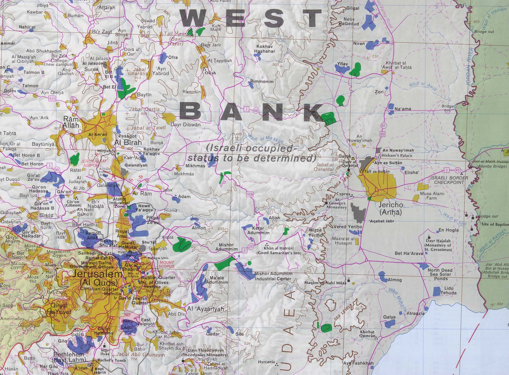
Last Update: 10/11/2003 12:28Separation fence to include wide area east of JerusalemBy Amos Harel, Haaretz CorrespondentThe route of the separation fence east of Jerusalem will include a wide swath of territory extending to the Alon Road and cliffs of Wadi Kelt, according to a plan prepared by the defense establishment.
--snip--
According to the current plan, which may still be subject to revision, the fence will approach A-Ram, near the Atarot airport and Qalandiyah refugee camp. It will then turn east, encompassing the Geva Binyamin (Adam) settlement, and continue as far as the cliffs of Wadi Kelt and the Alon Road. (No fence will be necessary along the Wadi Kelt cliffs, which constitute a natural barrier.)
At the Good Samaritan junction, the fence will turn southwest, circling around Ma'aleh Adumim and linking up with the existing fence to the north and east of Abu Dis and Azzariyeh. (Most of the residents of these two communities will not be included within the confines of the fence.) The fence will be integrated into the E-1 plan approved by the Netanyahu government toward the end of its term in 1999. The E-1 plan greatly expanded the territorial jurisdiction of Ma'aleh Adumim. Though there are relatively few Palestinians living in this area - with the exception of the Jahalin Bedouin tribes near Ma'aleh Adumim - it is a large expanse similar in size to the "finger" planned in the Ariel region, further north in the West Bank.
--snip--
http://www.haaretz.com/hasen/spages/358831.htmlmap of the area to compare with (remove space between ".edu/" and "maps/" to view):--
http://www.lib.utexas.edu/ maps/middle_east_and_asia/westbank_jericho92.jpg