Democratic Underground Latest Greatest Lobby Journals Search Options Help Login
Google

Gustav reportedly CAT 4 - 145 mph winds, expecting a 5 Get out now!

Printer-friendly format Printer-friendly format
Printer-friendly format Email this thread to a friend
Printer-friendly format Bookmark this thread
This topic is archived.
Home » Discuss » Archives » General Discussion (1/22-2007 thru 12/14/2010) Donate to DU
 
lonestarnot Donating Member (1000+ posts) Send PM | Profile | Ignore Sat Aug-30-08 01:05 PM
Original message
Gustav reportedly CAT 4 - 145 mph winds, expecting a 5 Get out now!
Be safe! :grouphug:
Printer Friendly | Permalink |  | Top
ProdigalJunkMail Donating Member (1000+ posts) Send PM | Profile | Ignore Sat Aug-30-08 01:05 PM
Response to Original message
1. just looked...WOW!!!
Printer Friendly | Permalink |  | Top
 
HCE SuiGeneris Donating Member (1000+ posts) Send PM | Profile | Ignore Sat Aug-30-08 01:10 PM
Response to Original message
2. Latest satellite pic...
Printer Friendly | Permalink |  | Top
 
lonestarnot Donating Member (1000+ posts) Send PM | Profile | Ignore Sat Aug-30-08 01:13 PM
Response to Reply #2
3. San dan donia! And Hanna is on his heals. Do you have one of her?
Printer Friendly | Permalink |  | Top
 
HCE SuiGeneris Donating Member (1000+ posts) Send PM | Profile | Ignore Sat Aug-30-08 01:30 PM
Response to Reply #3
15. Here you go...
Edited on Sat Aug-30-08 01:30 PM by BushDespiser12
Printer Friendly | Permalink |  | Top
 
HCE SuiGeneris Donating Member (1000+ posts) Send PM | Profile | Ignore Sat Aug-30-08 01:45 PM
Response to Reply #15
20. And an enlarged view...
Printer Friendly | Permalink |  | Top
 
Nikki Stone1 Donating Member (1000+ posts) Send PM | Profile | Ignore Sat Aug-30-08 01:18 PM
Response to Reply #2
8. Holy crap.
I'm having Katrina flashbacks.
Printer Friendly | Permalink |  | Top
 
roody Donating Member (1000+ posts) Send PM | Profile | Ignore Sat Aug-30-08 04:04 PM
Response to Reply #2
35. Look out Cuba!!
Oh yeah, they are ready, working together and even evacuate their refrigerators.
Printer Friendly | Permalink |  | Top
 
dkofos Donating Member (1000+ posts) Send PM | Profile | Ignore Sat Aug-30-08 01:15 PM
Response to Original message
4. Still 3 days out. No worries.
Printer Friendly | Permalink |  | Top
 
lonestarnot Donating Member (1000+ posts) Send PM | Profile | Ignore Sat Aug-30-08 01:16 PM
Response to Reply #4
5. If I lived there I'd still be worried, as I worry, that's just one of my
bad qualities. LOL
Printer Friendly | Permalink |  | Top
 
dkofos Donating Member (1000+ posts) Send PM | Profile | Ignore Sat Aug-30-08 01:19 PM
Response to Reply #5
10. Did you see the waves coming off Africa?
You can start worrying about them before they are even named.
Printer Friendly | Permalink |  | Top
 
lonestarnot Donating Member (1000+ posts) Send PM | Profile | Ignore Sat Aug-30-08 01:28 PM
Response to Reply #10
14. gee thanks!
lol
Printer Friendly | Permalink |  | Top
 
tpsbmam Donating Member (1000+ posts) Send PM | Profile | Ignore Sat Aug-30-08 02:03 PM
Response to Reply #5
22. Good and bad....
....which is so often true about many of our qualities. But caution is certainly warranted in situations like this! I'd already be outta there to avoid the evacuation traffic.....if your worry caused you to do the same then your worry would be a good thing. And my friends would likely be laughing at me as they often do. But then again they've been sorry sometimes when they haven't listened to me. I live in the mountains of NC (Asheville area) and warned friends to gas up before Katrina. They all thought I was out of my freaking mind. Well, come Katrina our prices shot up but worse, we had a gas shortage -- some stations closed completely and those that didn't had lines and rationed. It was relatively brief but I have to admit I smirked a little with my full tank of gas. LOL This time I said "get Gustav gas" and they're all doing just that!

I'm pretty low on worry but I'm high on caution and precaution. We have 5 houses on a well -- can't flush toilets if we lose power during storms. My neighbors used to laugh at me when I filled 2 bathtubs as bad ice/wind/rain storms neared (I do one now during the drought) -- I'm the one who is laughing when I can flush my damn toilets and they're all complaining they can't! :banghead: They know who the one with a storm kit is, who always has working flashlights, etc etc -- I don't worry because I'm prepared!

I just hope that all in the path of Gustav are safe, their loved ones are safe, their pets are safe.....there's nothing that can be done about the immovable material things (a house!) but as long as all of the living beings are safe, I'd deal with the rest as it arises. (Been there with a house being flooded -- just the basement, thank goodness -- worry did nothing but make me nuts -- didn't change the outcome.)
Printer Friendly | Permalink |  | Top
 
tsuki Donating Member (1000+ posts) Send PM | Profile | Ignore Sat Aug-30-08 01:17 PM
Response to Original message
6. We are packed. We are not going to ride this one out if it turns our
way.
Printer Friendly | Permalink |  | Top
 
dana_b Donating Member (1000+ posts) Send PM | Profile | Ignore Sat Aug-30-08 01:18 PM
Response to Reply #6
9. good.
which state are you in?
Printer Friendly | Permalink |  | Top
 
tsuki Donating Member (1000+ posts) Send PM | Profile | Ignore Sat Aug-30-08 09:21 PM
Response to Reply #9
39. In NW FL, on a barrier island. Waiting to see which way to go.
Printer Friendly | Permalink |  | Top
 
dana_b Donating Member (1000+ posts) Send PM | Profile | Ignore Sat Aug-30-08 01:18 PM
Response to Original message
7. I really hope that the people who are still in those lousy trailer homes
can get to the buses or some sort of transportation and get out. Maybe Gustav will spare LA.
Printer Friendly | Permalink |  | Top
 
Nikki Stone1 Donating Member (1000+ posts) Send PM | Profile | Ignore Sat Aug-30-08 01:19 PM
Response to Reply #7
11. There is funding for buses this time
http://www.wwltv.com/

There will also probably be a mandatory evacuation of NOLA tonight. However, a lot of people have been on buses out since yesterday.
Printer Friendly | Permalink |  | Top
 
MiniMe Donating Member (1000+ posts) Send PM | Profile | Ignore Sat Aug-30-08 01:26 PM
Response to Original message
12. Here is a projected path map from CNN


:scared:
Printer Friendly | Permalink |  | Top
 
Lorien Donating Member (1000+ posts) Send PM | Profile | Ignore Sat Aug-30-08 01:35 PM
Response to Reply #12
17. Yikes! I hope that it will track further South
The folks in the areas that were hit by Katrina are STILL living in a huge mess. At least Texas would get some REAL help from FEMA and the National Guard it they get the brunt of the storm.

I'm in Florida and we're already having monsoon like rains right now as Gustav's bands move through.
Printer Friendly | Permalink |  | Top
 
lastliberalintexas Donating Member (1000+ posts) Send PM | Profile | Ignore Sat Aug-30-08 09:54 PM
Response to Reply #17
40. Um, Texas didn't get much help from the feds when Rita hit
Why people think the response would be much better this time is beyond me.

S Texas is still recovering from Dolly, SE Texas is still recovering from Rita/Humberto/Eduoard, NOLA and points east are still recovering from Katrina, Florida from Fay. There just isn't a good place for Gus to land. :(
Printer Friendly | Permalink |  | Top
 
eShirl Donating Member (1000+ posts) Send PM | Profile | Ignore Sat Aug-30-08 01:27 PM
Response to Original message
13. kick
Printer Friendly | Permalink |  | Top
 
TahitiNut Donating Member (1000+ posts) Send PM | Profile | Ignore Sat Aug-30-08 01:32 PM
Response to Original message
16. Gustav has the potential to be worse for NOLA (in particular) than Katrina
Its projected track to the west of NOLA and its dramatically upgraded forecast intensity makes it a MAJOR threat. Please, please, please hope and pray that our fellow human beings in NOLA are safe.


Printer Friendly | Permalink |  | Top
 
EFerrari Donating Member (1000+ posts) Send PM | Profile | Ignore Sat Aug-30-08 01:37 PM
Response to Original message
18. Anybody seen Swampy?
:(
Printer Friendly | Permalink |  | Top
 
ncrainbowgrrl Donating Member (1000+ posts) Send PM | Profile | Ignore Sat Aug-30-08 02:13 PM
Response to Reply #18
25. I think I saw a thread where Swampy was evacuating.
Could be wrong though...
Printer Friendly | Permalink |  | Top
 
lonestarnot Donating Member (1000+ posts) Send PM | Profile | Ignore Sat Aug-30-08 02:18 PM
Response to Reply #25
28. Swampie knows he has to get out, my guess already gone! I'd love to hear from him though!
:worry:
Printer Friendly | Permalink |  | Top
 
EFerrari Donating Member (1000+ posts) Send PM | Profile | Ignore Sat Aug-30-08 03:02 PM
Response to Reply #25
30. Thanks, ncrainbowgirl. n/t
Printer Friendly | Permalink |  | Top
 
ncrainbowgrrl Donating Member (1000+ posts) Send PM | Profile | Ignore Sat Aug-30-08 05:10 PM
Response to Reply #30
36. no prob- I know how it is to worry about our DU friends!
:hi:
Printer Friendly | Permalink |  | Top
 
Fleshdancer Donating Member (1000+ posts) Send PM | Profile | Ignore Sat Aug-30-08 01:42 PM
Response to Original message
19. This is insane
My thoughts are with everyone affected by Gustav.
Printer Friendly | Permalink |  | Top
 
northernlights Donating Member (1000+ posts) Send PM | Profile | Ignore Sat Aug-30-08 01:48 PM
Response to Original message
21. tracking to the west of NOLA
won't that put the storm surge directly over NOLA? And Hannah is coming on right behind....holy freakin crap.
Printer Friendly | Permalink |  | Top
 
entanglement Donating Member (1000+ posts) Send PM | Profile | Ignore Sat Aug-30-08 02:04 PM
Response to Original message
23. They under predicted its intensity - worrying
Printer Friendly | Permalink |  | Top
 
RL3AO Donating Member (1000+ posts) Send PM | Profile | Ignore Sat Aug-30-08 02:09 PM
Response to Reply #23
24. Hard to forecast rapid intensification.
But they did say this on Thursday night.

"HOWEVER...IT WOULD BE NO SURPRISE IF RAPID INTENSIFICATION OCCURRED AND GUSTAV BECAME A CATEGORY 4 OR 5 HURRICANE BY 72 HR."
Printer Friendly | Permalink |  | Top
 
RL3AO Donating Member (1000+ posts) Send PM | Profile | Ignore Sat Aug-30-08 02:14 PM
Response to Original message
26. Key West radar
Printer Friendly | Permalink |  | Top
 
roamer65 Donating Member (1000+ posts) Send PM | Profile | Ignore Sat Aug-30-08 02:19 PM
Response to Reply #26
29. Once it gets north of Cuba, its gonna pick up steam fast.
Edited on Sat Aug-30-08 02:22 PM by roamer65
Please be safe and get out of its way, DU'ers.

:grouphug:
Printer Friendly | Permalink |  | Top
 
Feron Donating Member (1000+ posts) Send PM | Profile | Ignore Sat Aug-30-08 02:16 PM
Response to Original message
27. Well if it keeps on its current track..
I'll be okay. I have supplies and just have a few loose ends around the house to tie up.

I'm planning on staying, but if things change I'm leaving.

I just feel so sorry for the Cubans right now. Hopefully there will be no loss of life.
Printer Friendly | Permalink |  | Top
 
tannybogus Donating Member (1000+ posts) Send PM | Profile | Ignore Sat Aug-30-08 03:04 PM
Response to Original message
31. Even if you live inland, be ready.
Google Hurricane Camille. It devastated VA with rain.
Also,Hugo came ashore at Charleston, smashed to the center of the state in Columbia,
and then turned north and took out Charlotte. Lots of people were in those
cities trying to escape. Flooding and power can be major problems.

I can't conceive what a cat5 will do much less something stronger.
The only way I can even begin is to look at before and after Camille pictures.
Printer Friendly | Permalink |  | Top
 
ms liberty Donating Member (1000+ posts) Send PM | Profile | Ignore Sat Aug-30-08 10:19 PM
Response to Reply #31
41. I live about 65 miles NW of Charlotte, and Hugo's eye went over about 20 miles W of us...
and it was still at hurricane strength, although just barely. It was bad enough to do a helluva lot of damage to homes, a lot of damage from trees uprooted or felled, power lines downed everywhere; I was out of power for 10 days myself...and had poison ivy at the same time, which really sucked.

Printer Friendly | Permalink |  | Top
 
hedgehog Donating Member (1000+ posts) Send PM | Profile | Ignore Sat Aug-30-08 03:24 PM
Response to Original message
32. Wasn't Katrina a Cat 3?
Printer Friendly | Permalink |  | Top
 
mwooldri Donating Member (1000+ posts) Send PM | Profile | Ignore Sat Aug-30-08 04:00 PM
Response to Reply #32
33. Katrina got up to Cat 5 but as it neared land got down to Cat 3. nt
Printer Friendly | Permalink |  | Top
 
gristy Donating Member (1000+ posts) Send PM | Profile | Ignore Sat Aug-30-08 04:04 PM
Response to Original message
34. This Public Advisory just posted by NWS - Cat 5 possible
http://www.nhc.noaa.gov/text/refresh/MIATCPAT2+shtml/302053.shtml?

000
WTNT32 KNHC 302053
TCPAT2
BULLETIN
HURRICANE GUSTAV ADVISORY NUMBER 25
NWS TPC/NATIONAL HURRICANE CENTER MIAMI FL AL072008
500 PM EDT SAT AUG 30 2008

...GUSTAV STILL STRENGTHENING AS IT IMPACTS WESTERN CUBA...

AT 500 PM EDT...2100 UTC...A HURRICANE WATCH IS ISSUED FOR THE
NORTHERN GULF COAST FROM EAST OF HIGH ISLAND TEXAS EASTWARD TO THE
ALABAMA-FLORIDA BORDER...INCLUDING THE CITY OF NEW ORLEANS AND LAKE
PONTCHARTRAIN. A HURRICANE WATCH MEANS THAT HURRICANE CONDITIONS
ARE POSSIBLE WITHIN THE WATCH AREA...GENERALLY WITHIN 36 HOURS.

AT 500 PM EDT...A TROPICAL STORM WATCH IS ISSUED ALONG THE PANHANDLE
COAST OF FLORIDA FROM EAST OF THE ALABAMA-FLORIDA BORDER EASTWARD
TO THE OCHLOCKONEE RIVER. A TROPICAL STORM WATCH MEANS THAT
TROPICAL STORM CONDITIONS ARE POSSIBLE WITHIN THE WATCH
AREA...GENERALLY WITHIN 36 HOURS.

A HURRICANE WARNING REMAINS IN EFFECT FOR THE CUBAN PROVINCES OF
PINAR DEL RIO...LA HABANA...CIUDAD DE LA HABANA...ISLA DE
JUVENTUD...MATANZAS...AND CIENFUEGOS. PREPARATIONS TO PROTECT LIFE
AND PROPERTY IN THE HURRICANE WARNING AREA SHOULD HAVE ALREADY BEEN
COMPLETED.

A HURRICANE WATCH REMAINS IN EFFECT FOR THE CENTRAL CUBAN PROVINCE
OF VILLA CLARA.

A TROPICAL STORM WARNING REMAINS IN EFFECT FOR THE CENTRAL CUBAN
PROVINCES OF VILLA CLARA...SANCTI SPIRITUS...CIEGO DE AVILA...AND
CAMAGUEY...AND FOR THE LOWER FLORIDA KEYS WEST OF THE SEVEN MILE
BRIDGE TO DRY TORTUGAS.

FOR STORM INFORMATION SPECIFIC TO YOUR AREA...INCLUDING POSSIBLE
INLAND WATCHES AND WARNINGS...PLEASE MONITOR PRODUCTS ISSUED
BY YOUR LOCAL WEATHER OFFICE.

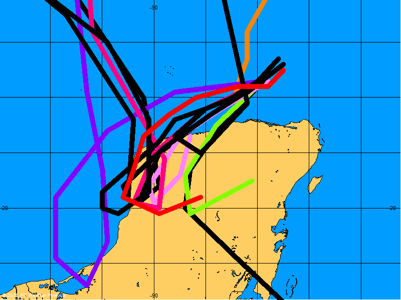
AT 500 PM EDT...2100Z...THE EYE OF HURRICANE GUSTAV WAS LOCATED
NEAR LATITUDE 22.1 NORTH...LONGITUDE 82.9 WEST OR ABOUT 130 MILES...
210 KM...EAST-NORTHEAST OF THE WESTERN TIP OF CUBA AND ABOUT 80
MILES...135 KM...SOUTH-SOUTHWEST OF HAVANA CUBA. DO NOT VENTURE
OUTSIDE DURING THE PASSAGE OF THE EYE...SINCE WINDS WILL SOON
RAPIDLY INCREASE AS EYEWALL AGAIN PASSES. THE EYE IS ALSO CURRENTLY
CENTERED ABOUT 620 MILES...1000 KM...SOUTHEAST OF THE NORTH-CENTRAL
GULF OF MEXICO COAST.

GUSTAV IS MOVING TOWARD THE NORTHWEST NEAR 15 MPH...24 KM/HR...AND
THIS GENERAL MOTION IS EXPECTED TO CONTINUE DURING THE NEXT COUPLE
OF DAYS. ON THIS TRACK...THE CENTER OF GUSTAV WILL CROSS WESTERN
CUBA TONIGHT...THEN EMERGE OVER THE SOUTHERN GULF OF MEXICO EARLY
ON SUNDAY...AND REACH THE NORTHERN GULF ON MONDAY.

DATA FROM AN AIR FORCE RECONNAISSANCE AIRCRAFT INDICATE THAT MAXIMUM
SUSTAINED WINDS HAVE INCREASED TO NEAR 150 MPH...240 KM/HR...WITH
HIGHER GUSTS. GUSTAV IS AN EXTREMELY DANGEROUS CATEGORY FOUR
HURRICANE ON THE SAFFIR-SIMPSON HURRICANE SCALE. SOME FLUCTUATIONS
WITH AN OVERALL SLIGHT STRENGTHENING IS FORECAST DURING THE NEXT 24
HOURS...AND GUSTAV COULD REACH CATEGORY FIVE INTENSITY DURING THIS
PERIOD.
GUSTAV IS FORECAST TO REMAIN A MAJOR HURRICANE THROUGH
LANDFALL ALONG THE NORTHERN GULF COAST.


HURRICANE FORCE WINDS EXTEND OUTWARD UP TO 70 MILES...110 KM...FROM
THE CENTER...AND TROPICAL STORM FORCE WINDS EXTEND OUTWARD UP TO 175
MILES...280 KM.

THE MINIMUM CENTRAL PRESSURE RECENTLY REPORTED BY THE RECONNAISSANCE
AIRCRAFT WAS 942 MB...27.82 INCHES.

COASTAL STORM SURGE FLOODING OF 18 TO 23 FEET ABOVE NORMAL TIDE
LEVELS...ALONG WITH LARGE AND DANGEROUS BATTERING WAVES...IS
POSSIBLE NEAR WHERE THE CENTER OF GUSTAV CROSSES WESTERN
CUBA...INCLUDING THE ISLE OF YOUTH. STORM SURGE OF 1 TO 3 FEET
ABOVE NORMAL TIDE LEVELS IS POSSIBLE IN THE DRY TORTUGAS AS GUSTAV
PASSES TO ITS WEST.

GUSTAV IS EXPECTED TO PRODUCE TOTAL RAINFALL ACCUMULATIONS OF 6 TO
12 INCHES ACROSS CENTRAL AND WESTERN CUBA...WITH ISOLATED MAXIMUM
AMOUNTS OF UP TO 20 INCHES POSSIBLE. THESE RAINS WILL LIKELY
PRODUCE LIFE-THREATENING FLASH FLOODS AND MUD SLIDES. RAINFALL
AMOUNTS OF 2 TO 4 INCHES ARE POSSIBLE OVER FLORIDA KEYS AND EXTREME
SOUTHERN FLORIDA. ADDITIONAL RAINFALL AMOUNTS OF 1 TO 2 INCHES ARE
POSSIBLE OVER THE CAYMAN ISLANDS.

ISOLATED TORNADOES ARE POSSIBLE TONIGHT OVER THE FLORIDA KEYS AND
THE SOUTHERN FLORIDA PENINSULA.

REPEATING THE 500 PM EDT POSITION...22.1 N...82.9 W. MOVEMENT
TOWARD...NORTHWEST NEAR 15 MPH. MAXIMUM SUSTAINED WINDS...150 MPH.
MINIMUM CENTRAL PRESSURE...942 MB.

AN INTERMEDIATE ADVISORY WILL BE ISSUED BY THE NATIONAL HURRICANE
CENTER AT 800 PM EDT FOLLOWED BY THE NEXT COMPLETE ADVISORY AT 1100
PM EDT.

$$
FORECASTER KNABB
Printer Friendly | Permalink |  | Top
 
csziggy Donating Member (1000+ posts) Send PM | Profile | Ignore Sat Aug-30-08 05:14 PM
Response to Original message
37. Computer models show some weird storm tracks for Gustav


But the ones that show Gustav changing direction are the ones that got it right for Fay.

Everybody, get out if you need to, hunker down if not, and be safe!
Printer Friendly | Permalink |  | Top
 
Hekate Donating Member (1000+ posts) Send PM | Profile | Ignore Sat Aug-30-08 05:23 PM
Response to Original message
38. Just got chills reading this. Stay safe, all you DUers. Get the hell out, and stay safe.
:grouphug:

Hekate


Printer Friendly | Permalink |  | Top
 
DU AdBot (1000+ posts) Click to send private message to this author Click to view 
this author's profile Click to add 
this author to your buddy list Click to add 
this author to your Ignore list Wed May 01st 2024, 07:18 AM
Response to Original message
Advertisements [?]
 Top

Home » Discuss » Archives » General Discussion (1/22-2007 thru 12/14/2010) Donate to DU

Powered by DCForum+ Version 1.1 Copyright 1997-2002 DCScripts.com
Software has been extensively modified by the DU administrators


Important Notices: By participating on this discussion board, visitors agree to abide by the rules outlined on our Rules page. Messages posted on the Democratic Underground Discussion Forums are the opinions of the individuals who post them, and do not necessarily represent the opinions of Democratic Underground, LLC.

Home  |  Discussion Forums  |  Journals |  Store  |  Donate

About DU  |  Contact Us  |  Privacy Policy

Got a message for Democratic Underground? Click here to send us a message.

© 2001 - 2011 Democratic Underground, LLC